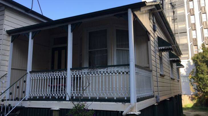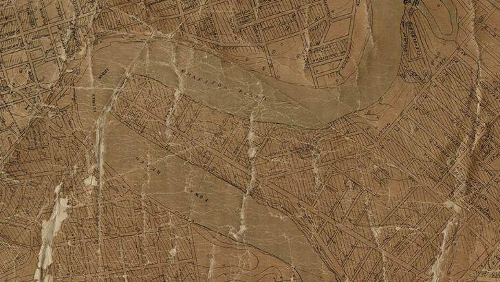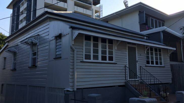


A recently-discovered 105-year-old survey map of early Brisbane will allow Brisbane City Council to protect a further 147 older Brisbane "timber and tin" homes built before 1911.
Subscribe now for unlimited access.
$0/
(min cost $0)
or signup to continue reading
Some have been found in the shadows of apartment towers at fast-expanding suburbs of South Brisbane, Kangaroo Point, West End and Toowong.
Finding the 1911 survey map in the city's archives has allowed Brisbane City Council to identify the "timber and tin" homes they were previously unaware existed.
Brisbane City Council and the Queensland Government were both embarrassed in early 2016 when a developer applied to demolish three Highgate Hill pre-1911 properties that Brisbane City Council's modern-day property searches simply did not reveal.
Queensland Government legislation subsequently could not prevent the buildings from being demolished after the Queensland Heritage Council ruled the properties did not meet their strict heritage guidelines.
Some of the recently-discovered older homes are in the shadows of the old 'Gabba cricket ground at Kangaroo Point and South Brisbane, while the other timber homes are scattered through the older parts of Brisbane, in Kedron, Lutwyche, Toowong, Nundah, West End, Windsor, Yeronga and Wooloowin.
Lord Mayor Graham Quirk will introduce planning steps to Tuesday's full council meeting to immediately protect the homes for 12 months.
Brisbane City Council will then make changes to the City Plan to make sure the protections are permanent, Cr Quirk said.
"Council will ensure these sites are afforded immediate protection under a proposed temporary local planning instrument (TLPI)," Cr Quirk said.
"This is part of our commitment to ensuring that longstanding, historically significant areas of our city's neighbourhoods are protected when considering any future development."
Cr Quirk explained how council's heritage staff searched old records, articles and aerial photographs to identify the houses after discovering the 1911 survey map.
"As part of research into historic homes, Council staff found an article in the 1914 edition of Queensland Surveyor titled Brisbane Sewage Surveys," Cr Quirk said.
"This included an extract of the 1911 contour survey map and they then made the exciting finding of the original map," he said.
"The surveyors marked the maps, dated 11 May 1911, with the areas occupied as well as individual houses."
Mayor expects law for protection to be accepted
He said the heritage unit then searched street by street to identify the older, timber homes.
Cr Quirk said he expects the new planning bylaw to protect the old timber homes would be adopted by Brisbane City Council on Tuesday.
"It requires approval by the Queensland Government before it is adopted and becomes effective for one year," he said.
Council is continuing to call for urgent changes to the Queensland Government's Building Act to stop private certifiers unlawfully demolishing pre-1946 homes in "character areas".
Brisbane City Council has warned Deputy Premier Jacki Trad and Housing Minister Mick de Brenni that a further 18 traditional building character properties could be illegally demolished.
Currently, a private certifier has five business days to provide local governments with copies of applications and approvals for demolitions.
"This means that Council often receives notification of demolition work after it has been carried out and it has no chance to scrutinise this," Cr Quirk said.
Council wants the State Government to make amendments to the Building Act requiring private building certifiers to provide Council with at least five days before "certified works" begin.
That would give Council time to issue "stop work" notices through the courts if necessary, Cr Quirk said.

